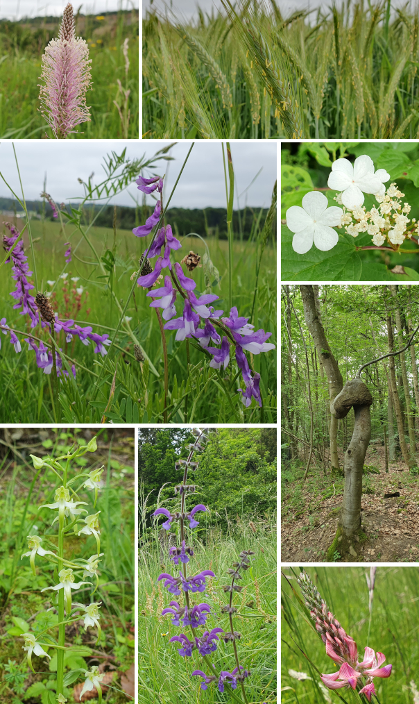
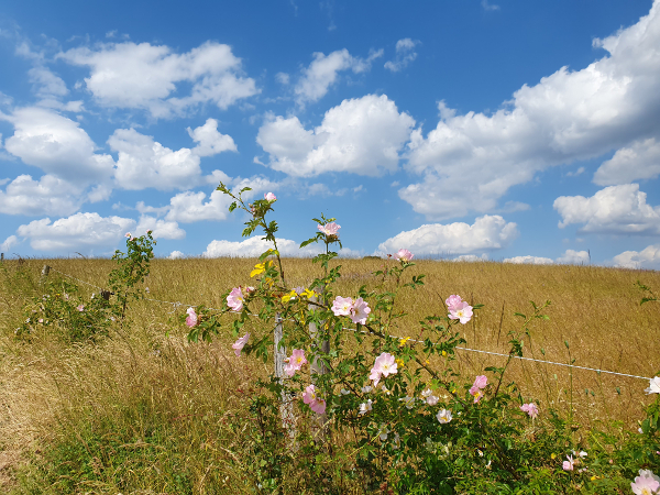
Ebenfalls Anfang Juni war ich auf der ca. 11 km langen Wasserfallrunde von Kerpen unterwegs. Bislang ging es zum Dreimühlen-Wasserfall in Nohn ja meist nur per Kurzvisiten und mit Fokus auf den legendären Waffeln im Café (der Besuch durfte auch dieses Mal natürlich nicht fehlen). Aber nun habe ich auch für ambitionierteren Besuch eine gute Strecke gefunden.
It was also at the beginning of June that I did the Waterfall Trail of Kerpen (about 11 km). Some of you might know that the waterfall Dreimühlen is a popular „quick“ destination with friends when the focus is often more on the legendary waffles at the café (I certainly didn’t pass on that this time, either). But I’ve now found a good trail for more ambitious visitors.
Den Wasserfall finde ich immer wieder schön – vielleicht hat er mich nur im Winter mehr fasziniert, als er quasi vollständig zugefroren war.
I can never get enough of that waterfall – it can only be more fascinating when frozen, as it was earlier this year.
Der Weg bringt einen auch nach Niederehe, wo es ein ziemlich beeindruckendes Kloster zu bestaunen gibt – zumindest von außen, denn Zugang gibt es nur zur Kirche. Aber das lohnt sich. Gerade vorgestern war ich nochmal dort, das war ein ganz besonderes Erlebnis, denn da wurde gerade geprobt für eine Hochzeit. Besichtigung zum Klang von Gesang und Trompete.
We pass by Niederehe as well where you can find an impressive (former) monastery. It’s not open for visitors but the church is. And that is well worth it.Just a couple of days ago I was there again and that turned out to be a very special visit as some musicians were basically doing a final rehearsal for a wedding. Sightseeing to the sound of a singer and a trumpet.
Ihr wisst: keine Wanderung ohne „Grünzeug“:
You are well aware: no hike without „greenery“:
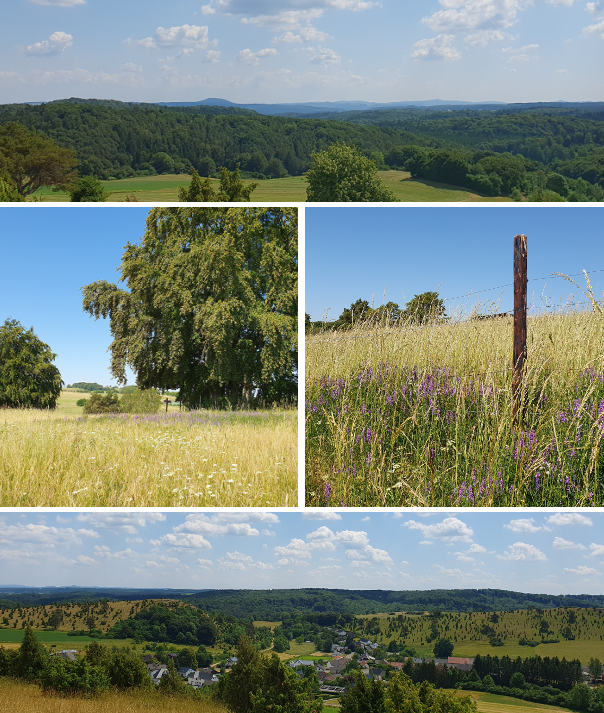
Anfang Juni (und im Prinzip aufgrund des vielen Regens ja immer noch) war grün sowieso (farb)tonangebend – mich faszinieren solche Blicke, bedeckter Himmel hin oder her:
The beginning of June (and really, even now at the end of July, due to all the rain we’ve had), green was the color of the day – I am fascinated by views like this, overcast sky or not:
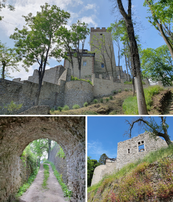
Auf dem letzten Fünftel oder so bin ich glaube ich von der Route abgekommen und bin einer Etappe des Eifelsteigs nach Kerpen gefolgt. Ich bin nicht sicher, ob man auch auf der Wasserfallroute an der Burg in Kerpen vorbeikommt… wahrscheinlich nicht, denn ich habe dann kein Schild mehr gesehen.
I think I lost the actual Waterfall Trail on the last fifth or so of the hike and followed a leg of Eifelsteig back to Kerpen. I’m not sure whether the planned hike would have taken me by the castle of Kerpen as well… probably not because I saw no more signs.
Oh ja, über viele Wanderungen wäre zu berichten – aber die letzten Wochen musste der Fokus dann doch deutlicher auf der Aktivität an sich als der Berichterstattung darüber liegen. Der Dauerregen heute allerdings ist meine Chance… und nebenher kann man auch noch Olympia gucken. Unterwegs auf dem Traumpfädchen Eifeltraum war ich Anfang Juni 2024.
Oh yes, there are still many hikes to talk about – but the last few weeks had me focus on the actual hikes instead of allowing time for blogging about them as well. The fact that today has non-stop rain in store for us helps me out… and I can even watch some of the Olympic Games on the side. I did this Traumpfädchen Eifeltraum at the beginning of June 2024.
Der Name des Parkplatzes bei Kürrenberg, Rhododendron, war schon vielversprechend, auch wenn die Blüte schon durch war. Die nur kleine Runde, gut 5 km, hatte erstaunlich viel verschiedenes zu bieten.
The parking lot near Kürrenberg won me over immediately: it’s called „Rhododendron“. The bloom was over but still. This little hike, only about 5 km, had quite a few things to offer.
Dass es offenbar das Jahr des Fingerhuts ist, habt ihr vielleicht mittlerweile selbst auch bereits bemerkt – und ich hatte Glück und auch noch einen richtig schönen Tag erwischt. Deswegen auch die Wahl der eher kurzen Runde, denn danach ging’s noch ins Schwimmbad. Auch ein Erlebnis: das Nettebad in Mayen im Prinzip vollkommen allein für mich.
Maybe you’ve already noticed it yourselves, apparently it’s the year of the foxglove – and on top of that it was a glorious day. That was one reason why I chose a shorter hike because I added a visit to Nettebad in Mayen. That turned out to be quite the experience: a whole public pool all to my myself.
Dabei war ich schon kneippend unterwegs, denn auch das bietet diese kleine Runde:
Swimming on top of a Kneipp experience, which is also part of this little trail:
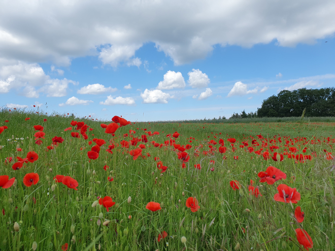
Hier hätte ich auch einfach stehen bleiben können, rechts der Mohn, links eine kleine Herde „Eifel-Zebus“…
It felt like a perfect spot to stay for a while, the poppies to the right and a small herd of „Eifel zebu“ to the left…
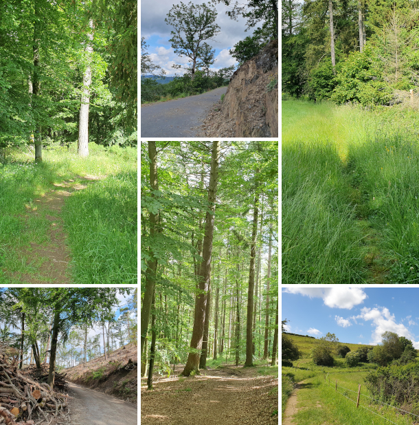
Und letztlich auch ziemlich abwechslungsreiche Wege, alles auf den 5 Kilometern:
And also quite a variety of trails, all on these 5 kilometers:
Ich komme nicht über den blauen Himmel bei angenehmsten Temperaturen. Mal gucken, was die nächste Woche bringt. Aber: Empfehlung für dieses Traumpfädchen, das Nettebad und eine Einkehr in Mayen.
I can’t get over the blue sky and the perfect temperatures on that day. Let’s see what kind of summer the coming week has on offer. Anyway: a recommendation for this trail and the Nettebad pool.
Abweichend von meinem normalen Vorgehen heißt der Wanderweg im Titel nicht wirklich so (wäre ja auch jahreszeitlich sehr eng gefasst), da er aber der eher unspezifische „Wanderweg 1“ in Neroth ist, konnte ich der Alliteration nicht widerstehen. Und je länger so ein Weg (16 km), je mehr Fotos – ich habe mal wieder gekämpft 😉
Today’s title does not follow my usual approach of using the actual name of the trail because that is a rather non-decsript „Hiking trail no 1“ in Neroth. I couldn’t resist the alliteration with the German word „Huflattich“, coltsfoot, which is abundant on this trail at this time of year. And the longer the trail (16 km), the more pictures – I’ve been choosing and editing forever 😉
Die Wege waren sehr abwechlungsreich, mein Lieblingsabschnitt ist aber wohl ziemlich zu Anfang, sobald man in den Nadelwald kommt, wo offenbar, abgesehen von Horden von Wildschweinen, die hier einiges umgraben, in großen Teil gefühlt keiner mehr langgegangen ist. Und die Rehe – da haben in der Ferne zwei Gruppen vor mir das Weite gesucht. Es war ein wunderbarer Tag und hätte ich ein Buch dabeigehabt, wäre ich sehr stark versucht gewesen, einfach ein Lager im Moos aufzuschlagen und Stunden im Vogelgezwitscher zu liegen und zu lesen.
The paths varied a lot but I will have to say that my favorite section was shortly after the start, when I first got deep into coniferous forest, which, apparently, hasn’t been frequented by anyone recently other than hordes of wild boars who dug up large parts, and the deer. I got to see two groups of the latter in the distance, deciding early on that they didn’t want to be near me. It was a gorgeous day and had I brought a book, I would have been very tempted to just lie down on the soft moss and stay there, listening to a cacophony of birds, and read.
Etwas befremdlich wird’s zum Ende dieses verwunschenen Teils, wenn man, wahrscheinlich auch nicht jeden Tag und zu jeder Zeit, immer intensiveres Geballer hört – besonders, wenn man nicht weiß, dass man auf einem Weg quasi direkt über der Standortschießanlage in Glees unterwegs ist. Den Blick darauf kriegt man in der Kurve, die auf der Kollage oben zu sehen ist. Dass ich überhaupt geteerte Wegstrecke mit aufnehme, hat aber tatsächlich einen anderen Grund: die ist hier (und nur hier) relativ lang, wenn auch verkehrsarm. Und es fehlt Beschilderung (nur aus der Gegenrichtung kommend ist sie eindeutig): in dieser Kurve tritt man aus dem Wald und muss der Straße bergauf folgen, bis an eine T-Kreuzung – wo man links abbiegt und weiter der Straße folgt. Ich glaube, ich habe ganze zwei sehr gut versteckte Schilder gesehen und war überhaupt nicht sicher, ob ich noch richtig bin.
This enchating section slowly gets a disconcerting note at the end when you start to hear louder and louder gun fire – luckily, that is explained once you reach the curve pictured in the collage above: it’s an army shooting range and the path runs above it more or less. The reason for including the road in the collage is a different one, though: there’s quite a long stretch you have to walk on it (luckily there’s not a lot of traffic) and it’s a spot where the signing is not ideal. You leave the forest, meet the road, and have to walk the road uphill until you get to a T-section, turn left and walk some more on asphalt. I think I found only two signs along the way and they were well hidden.
Beim ersten Bild oben bin ich irgendwie an einen Soldatenfriedhof erinnert – dabei ist es ja eher das Gegenteil, eher eine Kita. Was mag man wohl so eng zusammenpflanzen? Der kleine Abstecher zum Hochsitz lohnt sich, denn Bänke waren unterwegs ein bisschen Mangelware. Und in den roten Beuteln? Ich vermute Schafwolle, als Selbstbedienungstheke für Vögel beim Nestbau. Dann gab es auch noch Kunstinstallationen und eine Weihnachtsbaumschule.
The first picture of the above reminds me of a military cemetery when it is rather the opposite, rather a nursery school. I do wonder what was planted, leaving only little space between the plants? I took a tiny detour to the perched chair as benches were few and far in between. And the red bags? I believe they contained sheep’s wool, as a self-service facility for birds who build nests. I also came across some art installations and a Christmas tree nursery.
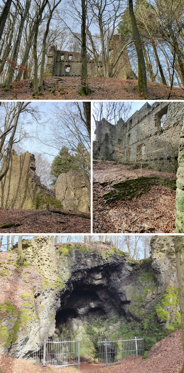
Das Ziel kurz vor Ende der Runde, die Burgruine Freudenkoppe bei Neroth, erreicht man u.a. über den Xynthia Steg, ein Weg durch die 2010 vom Orkan Xynthia geschlagene Verwüstungsschneise. Das Areal der 1340 erbauten und 1689 durch die Franzosen zerstörten Burg zu erfassen, fiel mir etwas schwer, denn es sind einige Gebäude, die im Buchenwald verteilt sind, und der Burgring baut auf einer Basalthöhle auf, in der Mühlsteine abgebaut wurden.
The castle ruins of Freudenkoppe near Neroth make the final destination about 2 km before the end of the hike. You use the Xynthia Trail, a path through the devastation caused by cyclone Xynthia in 2010, to reach the top. I had a bit of a hard time understanding the structure of the castle (built in 1340, destroyed in 1689 by the French) as there are a number of remnants scattered in the beech tree forest. And the old defense wall actually sits on top of a basalt cave wheren millstones were mined.
Der Weg abwärts ist lang und steil – ich war im Nachhinein noch dankbar, dass ich die Runde nicht gegen den Uhrzeigersinn gegangen bin. Das wäre so gar nicht meins gewesen, direkt am Anfang so ein Anstieg. Da bin ich wie ein Diesel, muss erst warm werden. Zur Einkehr kann ich vorbehaltlos die Kuchentheke in Die Mausefalle empfehlen. Nach 16 km sind da auch durchaus zwei Tortenhighlights drin.
The way down is long and steep – even in hindsight I was relieved that I had chosen not to walk the trail counterclockwise. I am not made for steep ascents in general and not at all right at the start of a hike. I’m much like a diesel engine when it comes to that, have to warm up first. But I can fully recommend the cake selection at Die Mausefalle (‚The Mouse Trap‘). And after 16km there is no reason whatsoever not to try at least two!
Hier ist der März und damit ist es Zeit für eine Urlaubswoche und die (fast) ersten Wanderungen des Jahres. Den Auftakt machte der 12 km lange Traumpfad Wanderather. Das Wetter war nicht ganz ideal, uns aber in der Summe gewogen.
March has come and not quite gone – high time for some vacation and the first hikes of the year (almost). We started out on the 12 km trail Traumpfad Wanderather. The weather wasn’t ideal but in all treated us okay.
So richtig hatte ich mir die Streckenführung vorher nicht angeguckt und war dann überrascht, im Nitztal auch in St. Jost vorbeizukommen, Station auf dem Pilgerweg von Barweiler nach Langenfeld, den ich als Kind ein paar Mal gegangen bin. Erschreckenderweise habe ich nichts wiedererkannt. Oder auch: was passieren kann, wenn man einfach nur stumpf hinterherläuft. Die spätgotische, vom Grafen Philpp von Virneburg erbaute Kapelle mit beeindruckendem barocken Altar wird 1436 erstmals urkundlich erwähnt. Ich lese nach, dass man hier pfingstmontags „Barockkonzerte“ besuchen kann.
I hadn’t really paid attention to the actual routing and was surprised to realize that our walk along the valley of the river Nitz brought us to the chapel of St. Jost, a stop on the pilgrim’s trail from Barweiler to Langenfeld. I walked that a few times as a kid but now had to concede that I didn’t recognize a thing. A fleeting thought that crossed my mind was that this can easily happen if you blindly follow. The Late Gothic chapel, first documented in 1436, was built by Count Philipp of Virneburg and today you can attend „baroque concerts“ there on Whitsun Monday.
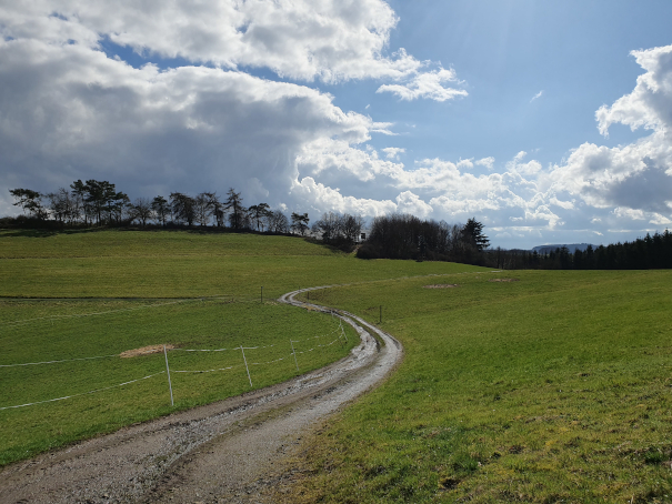
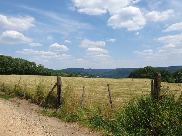
Die Route hat uns insgesamt sehr gut gefallen, sie war abwechlungsreich mit nur sehr wenig Asphaltanteil – aus dem Ort raus startet man direkt auf einem „Wiesenweg“. Die sind mir die liebsten und damit sind dann schon die ersten Pluspunkte gesammelt. Dazu schöne Aussichten und viel Himmel – was will man mehr. Witterungsbedingt war es oft und teilweise wirklich sehr matschig. Das wird sich sicher in Kürze wieder anders darstellen.
We really enjoyed this trail, it was very varied and had only little stretches on asphalt – right at the start you walk down a grass section. Those are by far my favorite so it easily earned the first bonus points. Lovely views and lots of sky – nothing left to be desired. Due to the very wet past weeks, it was often and at times exceptionally muddy. But that will certainly change very soon.
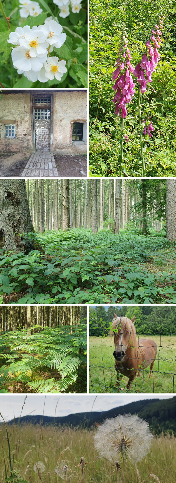
Blumen waren noch ein bisschen rar, aber da wird jeder weitere Tag jetzt wohl große Veränderungen bringen. Die Beschilderung war an sich gut, könnte aber hier und da nochmal erneuert werden (siehe Baumstamm unten) – da darf man sich nicht zu sehr verquatschen.
Flowers were still few and far in between but every day now will add more and more. The signposting as such was good but needs a little touch up here and there (e.g. the tree trunk below) – you need to pay attention and not get lost chatting.
Zurück in Wanderath haben wir noch einen Blick in die Kirche St. Valerius geworfen, deren Seitenschiff die ursprüngliche romanische Kirche aus dem 13. Jahrhundert ist, während nach einigen Bau- und Abrissmaßnahmen über die Jahrhunderte das jetzige Hauptschiff 1897 erbaut wurde. In Gästebüchern blättere ich immer gern und bin hier nochmal daran erinnert worden, dass auch die Eifel Geschichten zu bieten hat, wie sie in Vilhelm Mobergs Serie über die Auswanderer aus Småland absolut großartig erzählt wird (ordne ich wohl unter meine Top 3 ein). Leider ist mir kein ähnliches deutsches Werk bekannt.
Back at the start in Wanderath we went to see St. Valerius church: its one aisle is the original romanesque church from the 13th century while today’s nave was built in 1897 (with quite a few construction and demolishing events over the centuries). I always enjoy browsing guest books and in this one came across an entry that reminded me that the Eifel also has stories to tell that are similar to those of Vilhelm Moberg’s brilliant The Emigrants series, featuring a family from Småland – must be among the top 3 of my all-time favorites. I don’t know of any German book of similar scope and skill.
Nicht ganz die Zugspitze, aber immerhin die Hohe Acht, höchster Berg der Eifel – dahin hat es mich dann nachmittags gezogen. Auf dem Weg nach unten, nachdem ich das Gefühl schon kannte, hörte ich im Vorbeigehen einen Mann bei dem Ausblick oben sagen „Alter Schwede – das ist ja unfassbar!“
Not quite Zugspitze but Hohe Acht, the highest mountain in the Eifel – that is where I went next. On my way back down, recognizing that I had that same feeling on the way up, I heard a man who had stopped for the view above mutter „Son of a gun – that’s incredible!“
Die Atmosphäre ist ganz schwierig zu beschreiben – auf dem Turm, also noch 16 Meter über den 747m, ging ein strammer Wind und teilweise hatte man das Gefühl, man wäre mit dem Kopf direkt in den Wolken. Und das Treppenhaus hatte was von verlassener Forschungsstation in der Arktis.
It’s not easy to describe the atmosphere – there was a strong wind on the tower and thus 16 meters higher than the 747m of the mountain itself and sometimes I literally felt as if I had my head in the clouds. And the stairwell had the distinct feel of a deserted research station in the arctic.
Die Nürburg konnte man noch erkennen – mit dem sonst manchmal möglichen Blick bis zum Kölner Dom war es nix. Man könnte fast meinen, ich hätte schwarz-weiß fotografiert… und in dem Wetter wirkt die Burg noch trutziger, als es Burgen gemeinhin schon tun.
I could still make out Nürburg Castle – on other days you can see all the way to the cathedral in Cologne. It seems as if I had switched to black and white photography…. and this weather makes the castle appear even more of a stronghold than castles usually do.
Und gerade aus dem Turm getreten, wird plötzlich alles ganz anders, mehr Richtung Eiskönigin.
And upon leaving the tower, the atmosphere has changed completely and it was more like Frozen.
Wer mich kennt weiß, dass ich nicht viel mit Gedichten anfangen kann. Eines der wenigen, die in mir was zum Klingen bringen, ist „Stopping by woods on a snowy evening“ von Robert Frost…
Those of you who know me a bit also know that poetry is not my thing. One of the very few poems that somehow touches a string is „Stopping by woods on a snowy evening“ by Robert Frost…
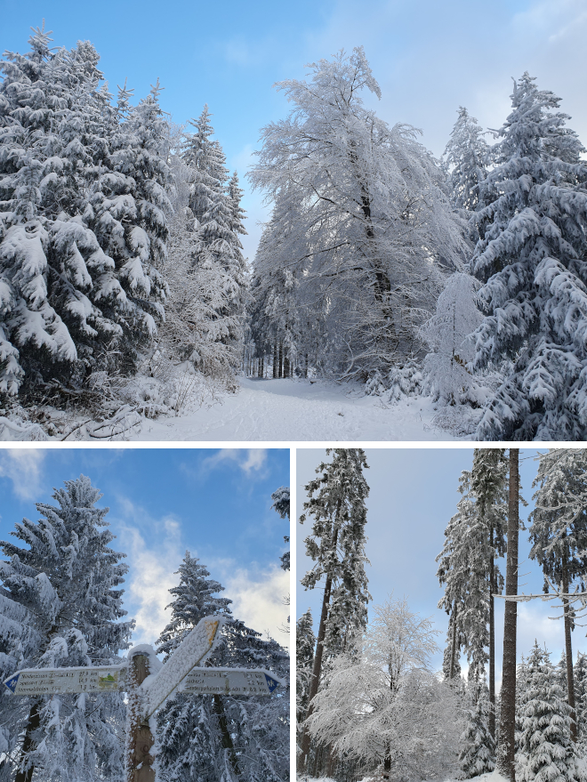
Blizzard-ähnliche Zustände wurden uns ab dem späten Vormittag eines Mittwochs im Januar versprochen vorhergesagt. Nach einer Nacht in Bonn machte ich mich morgens entsprechend früh auf zurück in die Eifel und kam mir vor, als wäre ich unterwegs in das Zentrum einer atomaren Katastrophe – nach Abfahrt von der Autobahn kein Auto vor oder hinter mir, fast bis nach Hause, nur Gegenverkehr. Und es wurde auch fies, Mittwoch und Donnerstag.
They had promised us forecast blizzard-like conditions starting in the late morning of a Wednesday in January. I had spent the night in Bonn and decided to find my way home to the Eifel early that morning and felt like I was headed into the center of a nuclear catastrophe – after I had left the highway, there was no car behind or in front of me, almost all the way home. Only oncoming traffic. And it did turn nasty, on Wednesday and Thursday.
Aber dann kam der Freitag, den ich durch eine schicksalhafte Fügung frei hatte. Es war unbeschreiblich schön und ich wusste nicht, wo ich zuerst hinfahren sollte. Dann auch noch die Meldung, dass die Lifte an der Hohen Acht aufmachten und die Loipen gespurt waren. Schlitten? Langlauf? Wandern? Immer diese Entscheidungen! Ich habe mich dann, vielleicht unbewusst, für die Einsamkeit entschieden und bin den Rest des Tages in der Summe vielleicht 10 Menschen begegnet.
But then Friday came which – as fate would have it – I had off. It was gorgeous beyond words and I really sat here wondering where to go first. The decision was not made any easier when the news came in that the ski lifts at Hohe Acht were in business and the cross country trails were prepared. Sleigh? Cross-country skiing? Hiking? Decisions! I opted for hiking in the end, maybe subconsciously choosing solitude, and saw no more than 10 other faces for the rest of the day.
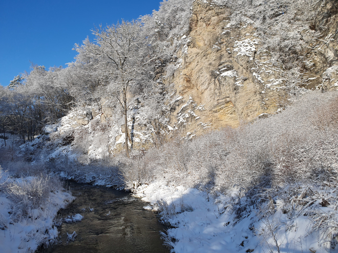
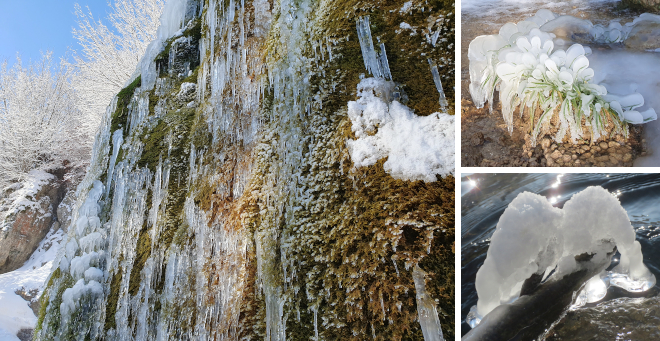
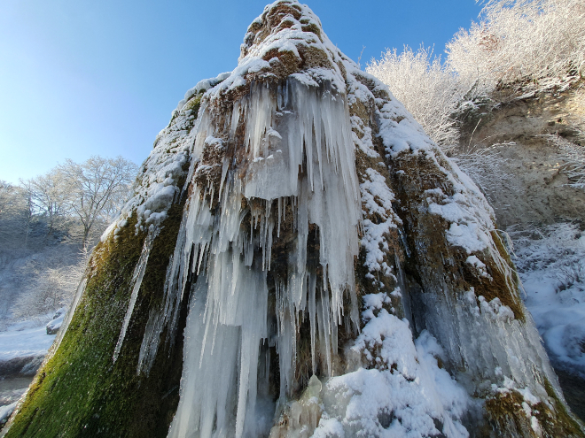
Auf zum Nohner Wasserfall / Wasserfall Dreimühlen – den wollte ich immer schonmal bei Minusgraden unter die Lupe nehmen und wurde nicht enttäuscht. Da kann man stundenlang stehen und kleinste Details finden und bestaunen.
The first destination was the waterfall in Nohn / Waterfall Dreimühlen – I had always wanted to check that out in minus temperatures and wasn’t disappointed. You can literally spend hours looking at a gazillion little details.
Und von allen Seiten – ich hatte in meiner „wo fahr ich nur hin?“-Hektik noch nicht mal Tee dabei, um selbigen in diesem Wunderland am glucksenden Bach in der Sonne sitzend zu genießen…
And from all sides – and in my somewhat stressed out „where do I go?“ moment I hadn’t even given it a thought that some hot tea might be perfect while sitting in the sun near the quietly gurgling brook…
Und findet ihr nicht auch, dass er aus dieser Perspektive verdammt imposant ist? Irgendwie war ich erinnert an Manny aus Ice Age…
And don’t you agree that it looks really impressive from the front? Doesn’t it look a bit like Manny, the mammoth of Ice Age fame?
Schonmal vereistes Moos gesehen, das ein glasklarer Spiegel ist? Guckt genau hin! Das jedenfalls war mein Vormittag – mein Nachmittag folgt in Kürze in einem weiteren Beitrag.
Have you ever seen moss that’s covered in ice so perfectly that it acts as a mirror? Look closely! Anyhow, that was my morning – there will be a separate post on the afternoon in a bit.
Jetzt geht es schon rasant auf das Ende des Juli zu und ich habe noch von einer Wanderung im Juni zu berichten… Aber so ist das im Sommer: viel draußen, viel Garten, viele Parties! Aber im Frühjahr kam ich auf dem Weg von Bitburg nach Hause durch Mürlenbach und war erstaunt ob der imposanten Burg, die da über dem kleinen Dorf thronte. Schnell war klar: hier muss ich wieder hin! Und dann war es soweit, auf der Bertrada-Tour.
I can’t believe that July is basically over already… and I still want to tell you about a hike I did in June. But that’s summer: outside a lot, in the garden a lot, many a party! This spring I came through Mürlenbach on my way home from Bitburg and was astonished to see the castle there, towering over the little village. Soon my mind was made up: I have to come back! And then I did, to hike the Bertrada Tour.
Es war ein wunderbarer Tag – fast ein bisschen zu warm, aber die Routenführung durch viel Wald war perfekt. An sich. Wenn nicht wieder ein Schild gefehlt hätte. Irgendwo im Nirgendwo haben wir dann klein beigegeben und das Kartenwerk des großen G zurate gezogen und uns querbeet zum nächsten Highlight leiten lassen, einer weiteren XXL Bank. Im Prinzip auch fast egal, denn der Weg ist das Ziel und man hat sich ja auch immer was zu erzählen.
It was a gorgeous day – almost a little too warm but the trail led us through lots of forested areas and was thus perfect. Generally. If it hadn’t been another case of a missing sign. „Somewhere“ we then decided to rely on the maps of the big G and fought our way to the next landmark, another XXL bench. And thinking about it: it really didn’t matter all that much as half the fun is getting there – and there’s always a lot to discuss, too.
An einem heißen Sommertag besonders zu empfehlen sind die Birresborner Eishöhlen, die am Wegesrand liegen. Innendrin ist es auf Dauer definitiv zu kalt – es wird nicht wärmer als 7 Grad und die Höhlen wurden früher als Eislager genutzt – aber den Eishauch spürt man schon, wenn man darauf zugeht.
A special recommendation for a hot summer’s day: the Ice Caves of Birresborn. They form part of the trail and while it is certainly too cold to spend much time inside (never warmer than +7°C, they were used as a storage room for ice long ago) you can feel the icy breeze emanating from them when approaching.
Große Empfehlung für die Bäckerei Blasius in Birresborn, da hat alles gestimmt: großes, leckeres Angebot, herzlicher Service – und Wlan für Kunden. Das tatsächlich auch funktionierte. Sowas gibt’s 😉 Nach dieser Pause zur Halbzeit bin ich alleine weiter und es zeigte sich: wenn man nicht quatscht und sich damit atmungstechnisch im Anstieg aus dem Rhythmus bringen lässt, ist das Tempo deutlich erhöht. Andererseits ist es aber schwierig zu beurteilen, denn es kam zu keiner weiteren zeitraubenden „Exkursion.“
A great shoutout to the Blasius Bakery in Birresborn, they had it all: large and yummy variety, friendly service – and wifi for the customers. Which worked, too. There are in fact places like that! 😉 I continued by myself after that break about half-way down the trail and noticed that ascents can be scaled a lot faster when there’s no chatting that disturbs your breathing rythm! But then a comparison is difficult because there were no more time-consuming „excursions“.
Und dann kommen wir noch zur besagten Bertrada Burg, auf die man zum Ende der Tour zugeht. Ich bin dann auch noch, am Auto vorbei, dorthin gestapft, aber leider kann man sie nicht besichtigen: sie ist in Privatbesitz und beherbergt Ferienwohnungen. So musste es bei Blicken durch die schmiedeeisernen Gittern bleiben.
And finally: Bertrada Castle, which you hike towards at the end of the trail. I decided to pass my parked car and get a closer look at it but unfortunately, it is privately owned and thus not open for visitors. But you can rent vacation apartments there. Anyhow, I had to make do with views through wroughtiron gates.
Und damit wünsche ich euch noch einen schönen Restsonntag und in Kürze einen guten Start in den August!
With this I’ll let you go! Enjoy what’s left of your Sunday and have a good start into August soon!
Diese Wanderung hatte ich mir schon letztes Jahr für diese Jahreszeit vorgenommen – um im Lampertstal hoffentlich auf viele blühende Orchideen zu treffen. Was das Detail betrifft kann ich vorwegnehmen, dass die Ausbeute eher enttäuschend war, nicht jedoch die Wanderung insgesamt. Es wird mal wieder ein bildgewaltiger Beitrag.
I had put this hike on my agenda for just this time of year last year already – hoping to find many orchids in bloom in Lamperts Valley. As concerns that very detail let me say up front that it was a little disappointing, but not the hike as a whole. Brace yourselves, it will be picture-heavy.
Mit Start auf einem großen, offenbar kürzlich angelegten Wanderparkplatz in Ripsdorf waren wir recht schnell in dem Teil, der aufgrund des Bewuchses die Toskana der Eifel genannt wird. Die Sicht war gut, Aremberg, Hohe Acht und Nürburg klar zu erkennen vom Gipfel des Kalvarienbergs, auf den ein im 17. Jh. angelegter Kreuzweg führt – oder sagen wir so: die ältesten Kreuze bzw. Kreuzwegstationen sind von 1675.
We started out from an apparently rather recently built parking lot for hikers in Ripsdorf and had soon reached the area that is called „Eifel Tuscany“ due to its vegetation. From the top of Kalvarienberg we were treated to excellent views of Aremberg, Hohe Acht and Nürburg. It’s part of a Way of the Cross that was set up in the 17th century – or to be on the safe side: the oldest crosses or stations of the cross are from 1675.
Auf dem Weg hinunter Richtung Kirche St. Agatha, es war noch nicht mal 12 Uhr, sahen wir ein Schild zum Café Stübchen und weil die Temperaturen denen der Toskana auch in nichts nachstanden, wurde eine erste Pause mit Kaltgetränk avisiert. Auf dem Weg dorthin überkam meinen Mitwanderer ein Verlangen nach Bockwurst mit Senf – da geriet ich in den Erwartungsmanagementmodus. Am Café angekommen war quasi gerade erst aufgeschlossen, die Theken noch leer… auf Nachfrage meinte die Betreiberin, Getränke habe sie auf jeden Fall, für Kuchen seien wir zu früh dran… aber wenn wir einen Moment Zeit hätten, könnte sie Bockwurst mit Senf anbieten. Und das, liebe Leser, nennt man gutes Karma.
On our way down towards the St. Agatha church – it wasn’t even noon yet – we saw a sign to Café Stübchen and as the temperatures were of Tuscany levels, too, we decided a first break with a cold drink was a good idea. Getting closer, my fellow hiker mentioned he could do with a sausage with mustard which made me get into expectation management mode. When we got to the café the owner had literally just opened up, the counters were still empty… when I enquired she said she could offer cold drinks but that we were too early for the cakes… but if we had a moment, she could offer sausages with mustard. And that, dear readers, is what you call good karma.
Nicht ganz unerwartet war die Kirche verschlossen, was mich mit Blick auf die Fotos die man vom Innenraum online findet, nochmal mehr ärgert. Aber was will man machen. Auf Richtung Lampertstal.
Not altogether unexpected, the church was locked. Looking at the pictures of the inside you can find online, I find that even more annoying. But there’s nothing you can do about it so on towards Lamperts Valley.
Blumen gibt es natürlich nicht nur im Lampertstal zu begutachten… man konnte die Kamera wieder mal unaufhörlich in sämtliche Richtungen halten.
Obviously, Lamperts Valley is not the only place to find flowers… it was another of those hikes where I didn’t know where to point the camera first.
Aber kommen wir mal zu den Orchideen, die dann doch nicht so einfach zu finden waren, wie erhofft. Wenn mich der kürzlich erschienene Führer „Orchideen der Vulkaneifel“ nicht vollkommen in die Irre geführt hat, haben wir das Rote Waldvöglein (Cephalantera rubra) gesehen – ich zögere, weil das Vorkommen beschrieben ist als „Kleinst-Populationen an ganz wenigen Standorten.“ Aber vielleicht ein weiterer Fall von gutem Karma?
But now let’s get to the orchids which turned out not to be as easily found as we had hoped. If I read the recently published guide on „Orchids of Vulkaneifel“ correctly, we did find what is called in German „Little Red Forest Bird“ (Cephalantera rubra) – I hesitate to state it as a fact because I’ve read also that there are basically only very, very few and far in between. But maybe another case of good karma?
Dann denke ich konnten wir die Mückenhändelwurz (Gymnadenia conopsea) sehen, ggf. die dichtblütige Variante – in der Mitte auf der Kollage unten. Die beiden anderen Pflanzen haben für mich auch was orchideenartiges, aber im Führer konnte ich sie nicht identifizieren. Sollte diesen Beitrag irgendwer lesen, der einen Plan von der Sache hat, bin ich für jede Korrektur u.ä. dankbar.
Another kind we saw is the chalk fragrant orchid (Gymnadenia conopsea), maybe a certain variant – in the middle of the collage below. The two others have quite an orchid air to me as well but the guide did not list them. If one of the readers of this post is more proficient than I am, thank you for leaving a comment with additional info and/or corrections.
Mit einem Blick auf Ripsdorf, wo wir auch wieder ankamen (wieder nicht ganz ohne Fragen die Ausschilderung betreffend) muss ich auch noch hervorheben, dass wir auch dort einkehren konnten – und das an einem Wochentag! Ich bin immer noch total geflasht. Bei Breuer konnten wir uns vor der Heimfahrt noch mit gekühltem Koffein versehen und ein bisschen im Hofladen shoppen.
With this view of Ripsdorf where we did make it (though again not without problems concerning the signposting) I would like to underline that we were able to stop for a cold drink again, at Breuer – and on a weekday at that! I am still recovering from the experience 😉 Before we headed home, we we had some cold caffeine and even did a little shopping in their farm shop.
Abschließend: eine abwechslungsreiche Runde, die ich empfehlen kann!
To wrap it up: a varied circular trail that I can recommend!
Die etwa 12 km lange Kleelandrunde um Sarmersbach hält, was sie verspricht: viel Wandern durch Weideland, dazu heller Buchenwald und etwas Nadelwald, topographisch eher wenig anspruchsvoll. Eine gemütliche Runde, auf der auch einige schön platzierte Bänke zu Pausen einladen. Vielleicht ein etwas zu hoher Anteil an asphaltierten landwirtschaftlichen Nutzwegen, aber wollen wir mal nicht zu kleinlich sein.
The Kleelandrunde („Clover Country Circular“) near Sarmersbach meets the (my) expectations: 12 km of easy hiking through meadows, a bit of light beech tree forest and a little less of coniferous forest, not very challenging topographically. Ideal for an unhurried stroll with quite a few benches inviting you to a short break. Maybe just a tad too much of the distance on paved agricultural roads.
Und da waren auch einige Blumen dabei, die ich sonst nicht so oft sehe UND Lupinen. Wir, die wir im vergangenen Jahr zusammen in Schweden unterwegs waren, stellten spätestens bei deren Anblick fest: Schweden geht auch in der Eifel! Lupinen, kleine Sträßchen im Nirgendwo, abschließend noch eine Einkehr zu „fika“ mit leckerem Kuchen und Kaffee – dann auf dem Rückweg im nicht allzu weit entfernten Kelberg.
And there were some flowers I don’t come across that often AND lupines. Finding the latter had the two of us, who had been been traveling in Sweden together last year, realize that you can do Sweden in the Eifel as well! Lupines, tiny roads in the boondocks and a „fika“ with cake and coffee to finish off the afternoon – on the back way back in nearby Kelberg.
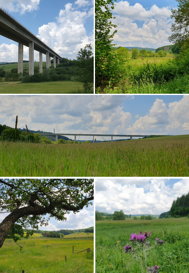
Auch mal ein längerer Blick und aus nicht gewohnter Perspektive auf die Liesertalbrücke der A1. Mit 602 m Länge und 55 m Höhe schon ein ziemlich beeindruckendes Bauwerk.
The hike also afforded us with excellent views – and from previously unknown angles at that – of Liesertal Bridge on A1. It’s 602 m long and 55 m high – quite impressive when you stand practically underneath it.
Der Weg war – auch wenn wir ihn „falschrum“ gegangen sind – perfekt ausgeschildert. Und hier auch mal der Hinweis auf die sehr gut gestaltete Website zu allen Wanderwegen rund um Sarmersbach – so cool kann eine lokale Webseite auch mal sein. Da kommt man gerne wieder!
The hike was – even if we did it against the recommended direction – perfectly signposted. And a shoutout to whoever is responsible for the local website on all hiking routes in the Sarmersbach area: great job! Makes us want to see more!
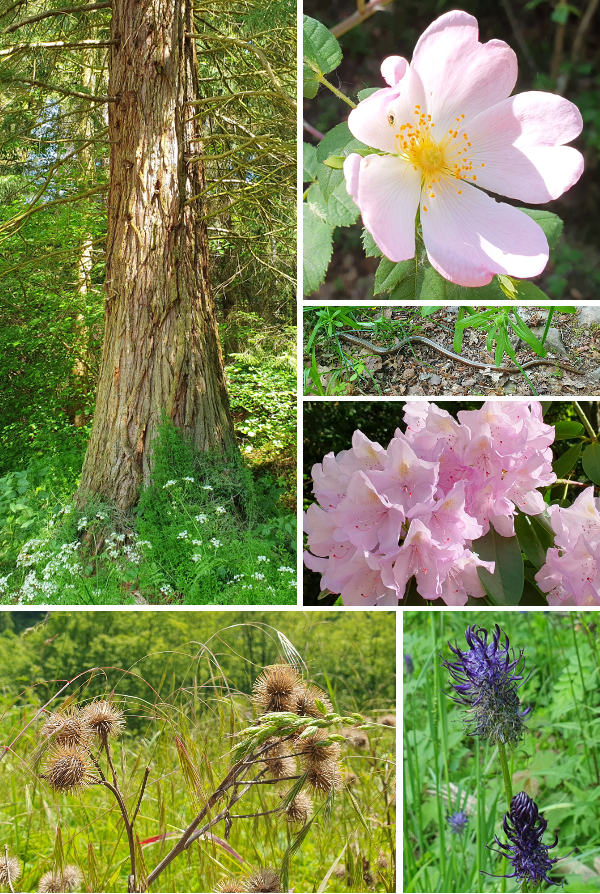
Diese Tour hatte ich schon mehrfach auf dem Plan und immer kam was dazwischen. Aber an diesem Samstag Anfang Juni war es soweit. Das Titelfoto ist etwas irreführend für die Eifelspur Kneippwanderweg in Bad Münstereifel, denn Aussichten gibt es nicht viele… ich erinnere mich an zwei. Aber es sind ja nicht zwingend die Aussichten, die zählen.
I had wanted to do this path in Bad Münstereifel a number of times but always something else got in the way. But on this Saturday at the begining of June it finally happened. The picture on top is a little misleading as what this path is a little low on is views… I remember two. But then you don’t necessarily need views to make it enjoyable.
Die Kommentare zu schlechter Beschilderung waren uns bekannt und wir können das – leider – in Teilen bestätigen. Der Einstieg war schon schwierig und mehr anhand der Beschreibung als der Beschilderung zu finden. Auch unterwegs fehlten Schilder bzw. waren zugewuchert. Es hat allerdings nicht dazu geführt, dass wir uns großartig verlaufen haben. Bei insgesamt doch vielen Teilstücken auf breiten Forstwegen haben wir die Passagen in lichten Buchenwäldern besonders genossen oder auch die „Ginster-Allee“:
We were aware of the comments on lack of proper signposting and – unfortunately – can confirm that is in part the case. Finding onto the path posed the first obstacle which we did more along the description than the signposts. Once on it, there were a few instances when signs were missing or overgrown. Not enough for us to get really lost, though. While quite a lot of the distance was along rather broad forest roads, we particularly enjoyed the parts in light beech tree forest or what we came to refer to as „Broom Alley“:
Wenige Meter abseits der Strecke ein „versteckter“ Teich – nur eine scheinbar etwas wundersam platzierte Picknickecke hat uns etwas genauer gucken lassen. Libellen, Kaulquappen und einfach nur schön.
A few meters off the path we found a „hidden“ pond – there was a strangely located picnic area that made us look around a little more. Dragonflies, tadpoles and just serene.
Und dann habe ich meine allererste Blindschleiche entdeckt bzw. wurde durch die etwas hektischen Bewegungen meiner Begleitung darauf aufmerksam. Ich hätte sie übersehen, trotz ihres kupfrig glänzenden Äußeren.
And then I got to see my first ever blindworm – or rather, I was made aware of it by the somewhat hectic movements of my fellow hiker. I would have walked right past, despite the copperlike sheen of its body.
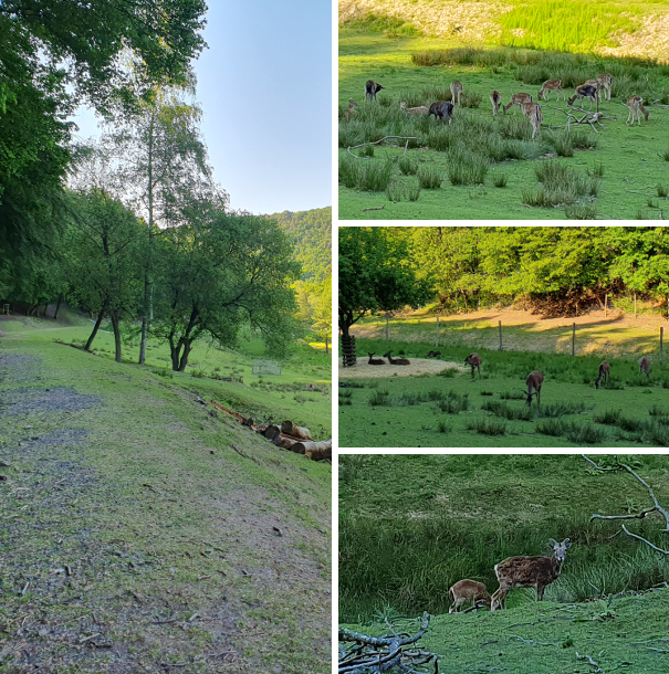
Auch wenn sich uns der Name für die Wanderung nicht erschließt (kein Kneipp-Bezug weit und breit – und besonders gegen Ende hätten wir gerne im Kurpark die Füße in ein Kneippbecken gesteckt), so empfanden wir die Durchquerung des Damwildgartens, ohne Zaun zu den Tieren, schon nochmal als kleines Highlight.
We ended the tour wondering what exactly the reference to Sebastian Kneipp in the name of the hike is about – and especially at the end of it, in the spa gardens, we would have appreciated one of the signature water-treading basins to cool our feet. But just a little before that there was a highlight nonetheless, passing through a fallow deer enclosure, without fence between us and the animals.
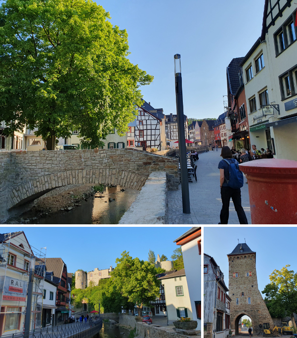
Und für den Fall, dass ihr euch fragt, ob denn Bad Münstereifel mit seiner wunderschönen Altstadt und dem City-Outlet nach der verheerenden Flutkatastrophe im Juli 2021 wieder den Besuch wert ist: ein klares Ja!
And just in case you were wondering whether Bad Münstereifel with its beautiful old city and „City Outlet“ is worth the visit again after the devastating floods of July 2021: absolutely!


 Die Kommentare zu schlechter Beschilderung waren uns bekannt und wir können das – leider – in Teilen bestätigen. Der Einstieg war schon schwierig und mehr anhand der Beschreibung als der Beschilderung zu finden. Auch unterwegs fehlten Schilder bzw. waren zugewuchert. Es hat allerdings nicht dazu geführt, dass wir uns großartig verlaufen haben. Bei insgesamt doch vielen Teilstücken auf breiten Forstwegen haben wir die Passagen in lichten Buchenwäldern besonders genossen oder auch die „Ginster-Allee“: