
Abweichend von meinem normalen Vorgehen heißt der Wanderweg im Titel nicht wirklich so (wäre ja auch jahreszeitlich sehr eng gefasst), da er aber der eher unspezifische „Wanderweg 1“ in Neroth ist, konnte ich der Alliteration nicht widerstehen. Und je länger so ein Weg (16 km), je mehr Fotos – ich habe mal wieder gekämpft 😉
Today’s title does not follow my usual approach of using the actual name of the trail because that is a rather non-decsript „Hiking trail no 1“ in Neroth. I couldn’t resist the alliteration with the German word „Huflattich“, coltsfoot, which is abundant on this trail at this time of year. And the longer the trail (16 km), the more pictures – I’ve been choosing and editing forever 😉

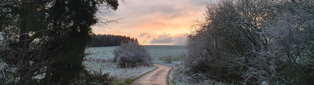
Die Wege waren sehr abwechlungsreich, mein Lieblingsabschnitt ist aber wohl ziemlich zu Anfang, sobald man in den Nadelwald kommt, wo offenbar, abgesehen von Horden von Wildschweinen, die hier einiges umgraben, in großen Teil gefühlt keiner mehr langgegangen ist. Und die Rehe – da haben in der Ferne zwei Gruppen vor mir das Weite gesucht. Es war ein wunderbarer Tag und hätte ich ein Buch dabeigehabt, wäre ich sehr stark versucht gewesen, einfach ein Lager im Moos aufzuschlagen und Stunden im Vogelgezwitscher zu liegen und zu lesen.
The paths varied a lot but I will have to say that my favorite section was shortly after the start, when I first got deep into coniferous forest, which, apparently, hasn’t been frequented by anyone recently other than hordes of wild boars who dug up large parts, and the deer. I got to see two groups of the latter in the distance, deciding early on that they didn’t want to be near me. It was a gorgeous day and had I brought a book, I would have been very tempted to just lie down on the soft moss and stay there, listening to a cacophony of birds, and read.

Etwas befremdlich wird’s zum Ende dieses verwunschenen Teils, wenn man, wahrscheinlich auch nicht jeden Tag und zu jeder Zeit, immer intensiveres Geballer hört – besonders, wenn man nicht weiß, dass man auf einem Weg quasi direkt über der Standortschießanlage in Glees unterwegs ist. Den Blick darauf kriegt man in der Kurve, die auf der Kollage oben zu sehen ist. Dass ich überhaupt geteerte Wegstrecke mit aufnehme, hat aber tatsächlich einen anderen Grund: die ist hier (und nur hier) relativ lang, wenn auch verkehrsarm. Und es fehlt Beschilderung (nur aus der Gegenrichtung kommend ist sie eindeutig): in dieser Kurve tritt man aus dem Wald und muss der Straße bergauf folgen, bis an eine T-Kreuzung – wo man links abbiegt und weiter der Straße folgt. Ich glaube, ich habe ganze zwei sehr gut versteckte Schilder gesehen und war überhaupt nicht sicher, ob ich noch richtig bin.
This enchating section slowly gets a disconcerting note at the end when you start to hear louder and louder gun fire – luckily, that is explained once you reach the curve pictured in the collage above: it’s an army shooting range and the path runs above it more or less. The reason for including the road in the collage is a different one, though: there’s quite a long stretch you have to walk on it (luckily there’s not a lot of traffic) and it’s a spot where the signing is not ideal. You leave the forest, meet the road, and have to walk the road uphill until you get to a T-section, turn left and walk some more on asphalt. I think I found only two signs along the way and they were well hidden.

Beim ersten Bild oben bin ich irgendwie an einen Soldatenfriedhof erinnert – dabei ist es ja eher das Gegenteil, eher eine Kita. Was mag man wohl so eng zusammenpflanzen? Der kleine Abstecher zum Hochsitz lohnt sich, denn Bänke waren unterwegs ein bisschen Mangelware. Und in den roten Beuteln? Ich vermute Schafwolle, als Selbstbedienungstheke für Vögel beim Nestbau. Dann gab es auch noch Kunstinstallationen und eine Weihnachtsbaumschule.
The first picture of the above reminds me of a military cemetery when it is rather the opposite, rather a nursery school. I do wonder what was planted, leaving only little space between the plants? I took a tiny detour to the perched chair as benches were few and far in between. And the red bags? I believe they contained sheep’s wool, as a self-service facility for birds who build nests. I also came across some art installations and a Christmas tree nursery.

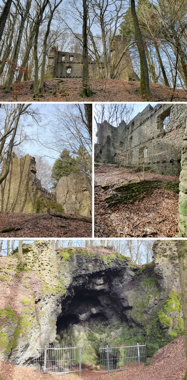
Das Ziel kurz vor Ende der Runde, die Burgruine Freudenkoppe bei Neroth, erreicht man u.a. über den Xynthia Steg, ein Weg durch die 2010 vom Orkan Xynthia geschlagene Verwüstungsschneise. Das Areal der 1340 erbauten und 1689 durch die Franzosen zerstörten Burg zu erfassen, fiel mir etwas schwer, denn es sind einige Gebäude, die im Buchenwald verteilt sind, und der Burgring baut auf einer Basalthöhle auf, in der Mühlsteine abgebaut wurden.
The castle ruins of Freudenkoppe near Neroth make the final destination about 2 km before the end of the hike. You use the Xynthia Trail, a path through the devastation caused by cyclone Xynthia in 2010, to reach the top. I had a bit of a hard time understanding the structure of the castle (built in 1340, destroyed in 1689 by the French) as there are a number of remnants scattered in the beech tree forest. And the old defense wall actually sits on top of a basalt cave wheren millstones were mined.
Der Weg abwärts ist lang und steil – ich war im Nachhinein noch dankbar, dass ich die Runde nicht gegen den Uhrzeigersinn gegangen bin. Das wäre so gar nicht meins gewesen, direkt am Anfang so ein Anstieg. Da bin ich wie ein Diesel, muss erst warm werden. Zur Einkehr kann ich vorbehaltlos die Kuchentheke in Die Mausefalle empfehlen. Nach 16 km sind da auch durchaus zwei Tortenhighlights drin.
The way down is long and steep – even in hindsight I was relieved that I had chosen not to walk the trail counterclockwise. I am not made for steep ascents in general and not at all right at the start of a hike. I’m much like a diesel engine when it comes to that, have to warm up first. But I can fully recommend the cake selection at Die Mausefalle (‚The Mouse Trap‘). And after 16km there is no reason whatsoever not to try at least two!
Barbara

Wonderful post! I am so glad you invited me along and showed me such interesting and beautiful sights. Thanks!
LikeLike
Wonderful hike!
Looks spectacular!
Great pictures!
Thanks for taking me!
LikeLike
Hallo Babsi, schön wieder was von dir zu lesen. 16 km sind schon ein Stiefel. Liebe Grüße Ulla
LikeLike